15 Dec Real traffic data as support for traffic planners
Speed reduction, parking ban or an encounter zone? Which traffic calming measure is most suitable is surveyed for the Kaiserfeldgasse in Graz. For this purpose, ALP.Lab, together with project partners, analysed the movements of all traffic participants – as an objective basis for a solid decision.
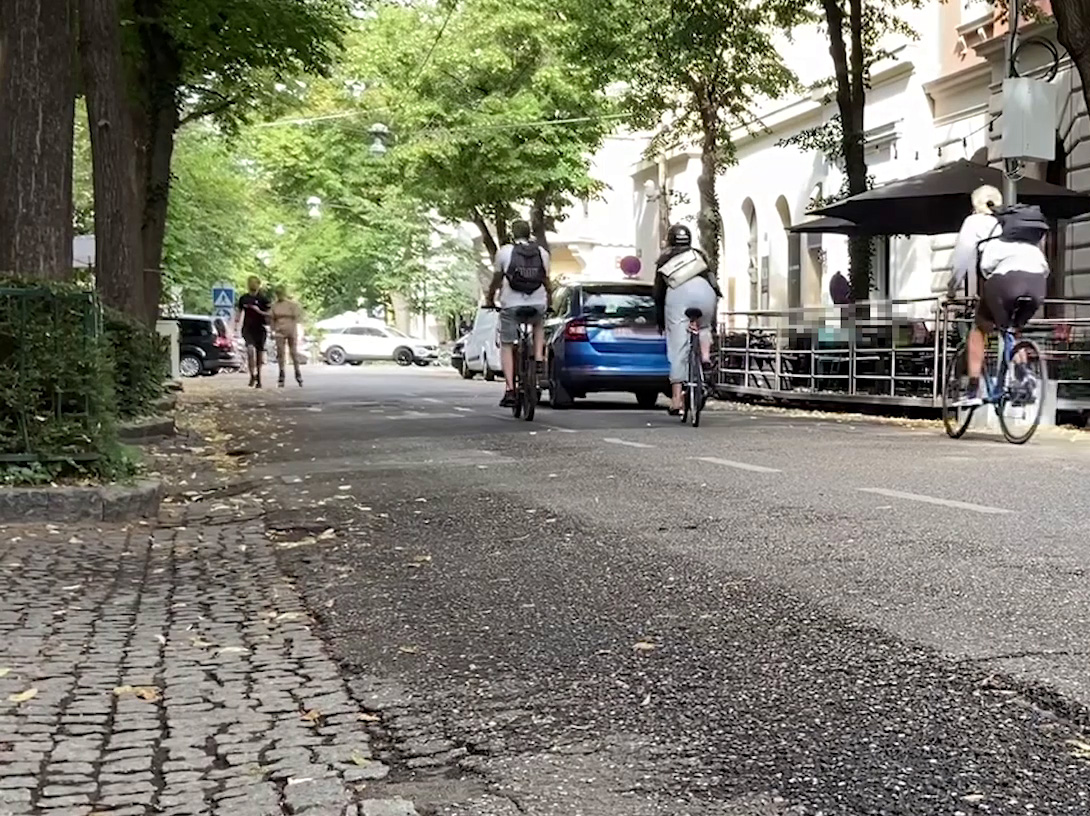
The Kaiserfeldgasse in the centre of Graz is a perfect example of multimodal transport use: bicycles, e-scooters, pedestrians, cars and many more bustle about on the street. The reasons for this are the numerous cafés and restaurants along the street, the immediate proximity to a pedestrian zone and the possibility of finding a car parking space in this very street.
At the request of the residents, the traffic concept of the street is now to be revised. Together with the partners Yunex Traffic and JOANNEUM RESERACH, ALP.Lab is preparing an objective evaluation basis for this – based on real traffic data.
More specifically, over a period of 6 weeks, more than 20 lidar, acoustic and optical sensors were installed in the street to document – anonymously – the movements of all road users. They are assigned to different categories, like pedestrians, vehicles, cyclists, etc. The collected data can be used to determine the traffic situation: statistical statements can be made about how many cyclists, pedestrians, etc. have crossed the street where and when, and whether critical situations with other road users have occurred.
Based on the results of this analysis, the reconstruction of Kaiserfeldgasse will follow. In order to check the success of the measure, the sensors will be installed again and the new measurement data will be compared with the archive data.
All in all, this will provide an objective basis for deciding which reconstruction measure is most suitable and the success achieved can be measured.
By combining four lidar sensors (“sensor fusion”), we were able to monitor a road section of about 200 metres.