Data management and backend systems

YouTube

By loading the video, you agree to YouTube's privacy policy.
Learn more

Load video

Digital twins of the physical environment and digitized information establish a basis for simulation and validation.

Therefore ALP.Lab offers ready to use UHD-maps of

  • public primary roads
  • toll stations
  • closed proving grounds focusing the Austrian road-characteristics

In addition,

  • ALP.Lab performs mapping of test tracks and public roads internationally
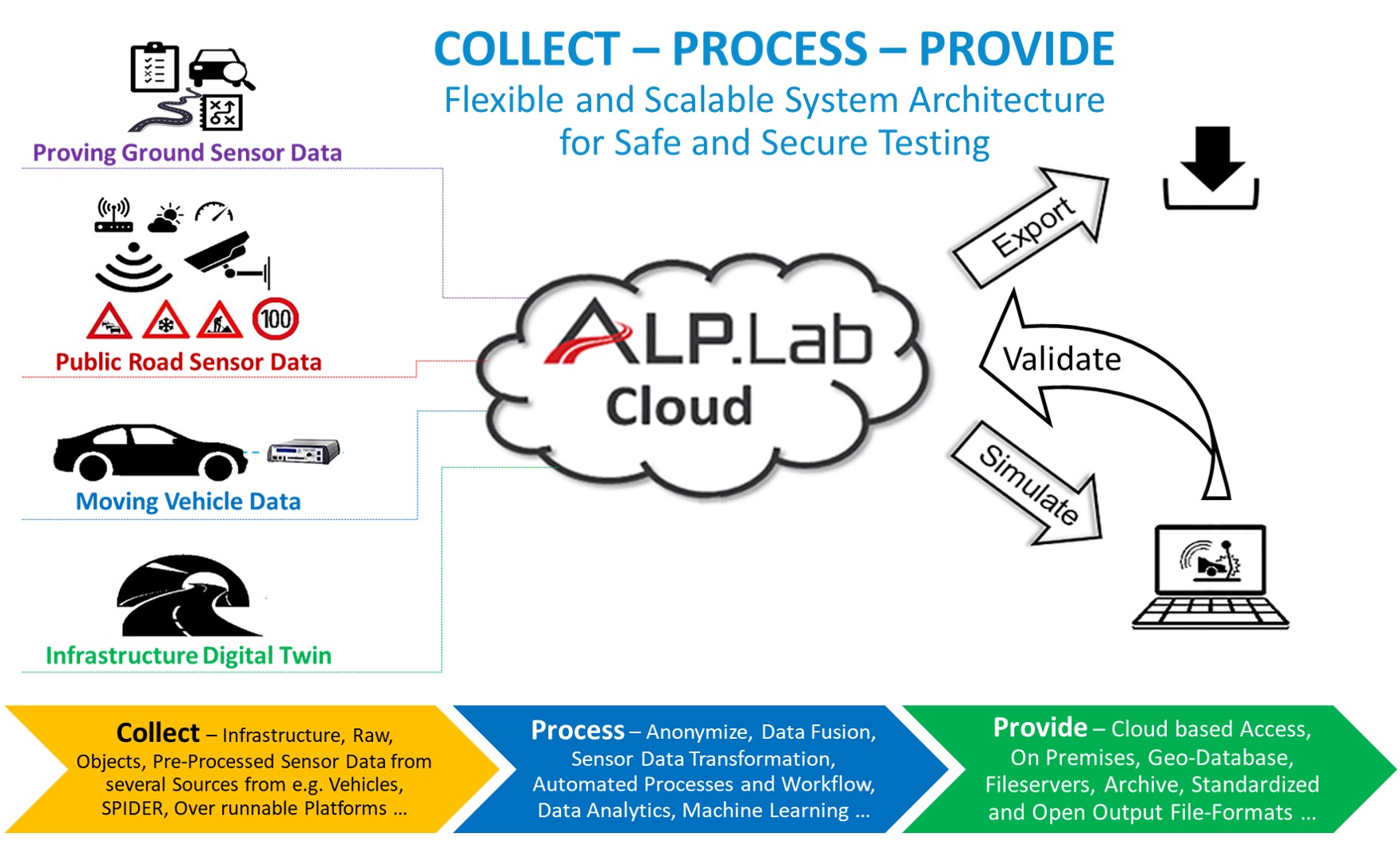
  • our cloud services and software-tools are available for data processing and analytics

Our services and products:

ALP.LAB CLOUD SERVICES

  • Collection of data
  • Tools and algorithms for data processing and analytics

UHD MAP - 400KM PRIMARY ROAD

  • Digital twin of 400km Austrian primary road
  • Available in several simulation data formats
  • Usable for simulation and validation

ULTRA HD MAP OF CLOSED PROVING GROUNDS

  • Digital twin of AVL Proving Ground in Gratkorn
  • Available in several simulation data formats
  • Usable for simulation and validation

ULTRA HD MAP OF PUBLIC TOLL STATIONS

  • Digital twin of public toll station
  • Characteristics of a border crossing
  • Available in several simulation data formats
  • Usable for simulation and validation

ULTRA HD MAPPING TOOL CHAIN FOR DIGITALIZATION OF TEST TRACKS AND PUBLIC ROADS (DIGITAL TWIN)

Open a video of the map here.

SOFTWARE TOOLS FOR AUTOMATED PROCESSING OF GROUND TRUTH AND MEASUREMENT DATA (FUSION, TRANSFORMATION, ANALYTICS)

  • Data processing in conformity with data privacy and protection
  • Video anonymization
  • Traffic data